Showing posts with label Birding sites. Show all posts

Saturday, March 24, 2018

Birding Puerto Vallarta


Birding in Mexico: Puerto Vallarta and around
October 2015

Birding is a kind of recreation that is spreading as a pastime, and I am happy about this. I have been an avid birder since I was 12 years old so, I've seen changes in America and Europe. One thing that does not change is the pull of exotic locations. And because field guides and the Internet now provide easy ways to identify and record birds (see ebird), birding in the tropics has never been better. 

This quick show records our wanderings around Puerto Vallarta at the time of Hurricane Patricia in October 2015 (11 day visit). We stayed mostly at Playa Las Gemelas ('bout 8 Km south of PV) and also spent two nights at San Blas. Much of the trip was spend applying a new assessment method for landscape (LAP protocol) - but we do not show this here. We concentrate on places and the birds...

Highly recommended. 


LOCATIONS

Near Playa Las Gemelas, we stayed at the Best Western (50 euros per night equivalent; amazing locale).

Mismaloya.

Yelapa (easy boat ride to the south).
Yelapa river.

Tiny tourist hamlet on boat trip to Yelapa.

Boat launch for trip to Yelapa.

Felt safe in Mexico.
Meeting with a spear-fisherman.

On a random look-out to do the LAP on the road to Guadalajara (near San Sebastian). The taxi driver who guided us was from Chicago.
San Sebastian had a quasi-Mediterranean montane climate that even had guava trees in full fruit - we ate lots. Felt very comfortable here.
San Sabastian.

Bus travel is the best way to move around and very cheap.

We travelled on many public buses; only one had recent bullet-holes. We also hitch-hiked once and we took many taxis (it was off-season so bartering gave us an edge).
San Sabastian, fashionable place to visit. And the pine cloud forests around it are exotic-looking. Amazing.
In a squatters hamlet near San Blas. Vasso is assessing the landscapes, the Taxi driver is guiding us. 
The buses are old but are suited for tourism use (and with anglicized titles). This one stopped for us towards from the Jardin Botanico to El Tuito; on the way back to Vallarta we hitched on to a very fast modern bus (nightmare speed...).
Jardin Botanico.

El Tuito village, well worth the trip (buy local bus).
Best view. Near Tepic far from San Blas. Waiting for the Macaws. Unforgettable.
Somewhere near San Blas, a sacred Guanocaste tree.

Vasso walks the rain forest trail in Jardin Botanico in slippers - then a fire ant bit her...

Chencho with his lovely Indian eyes is the best guide in the boat trip of the La Tovara mangroves, he showed us many birds, including a fantastic squirrel cuckoo. The day after Hurricane Patricia we where the only clients left in San Blas.
Vasso with the Huichol natives who are famous for their art and religion. They come down to San Blas to sell small things.


BIRDS

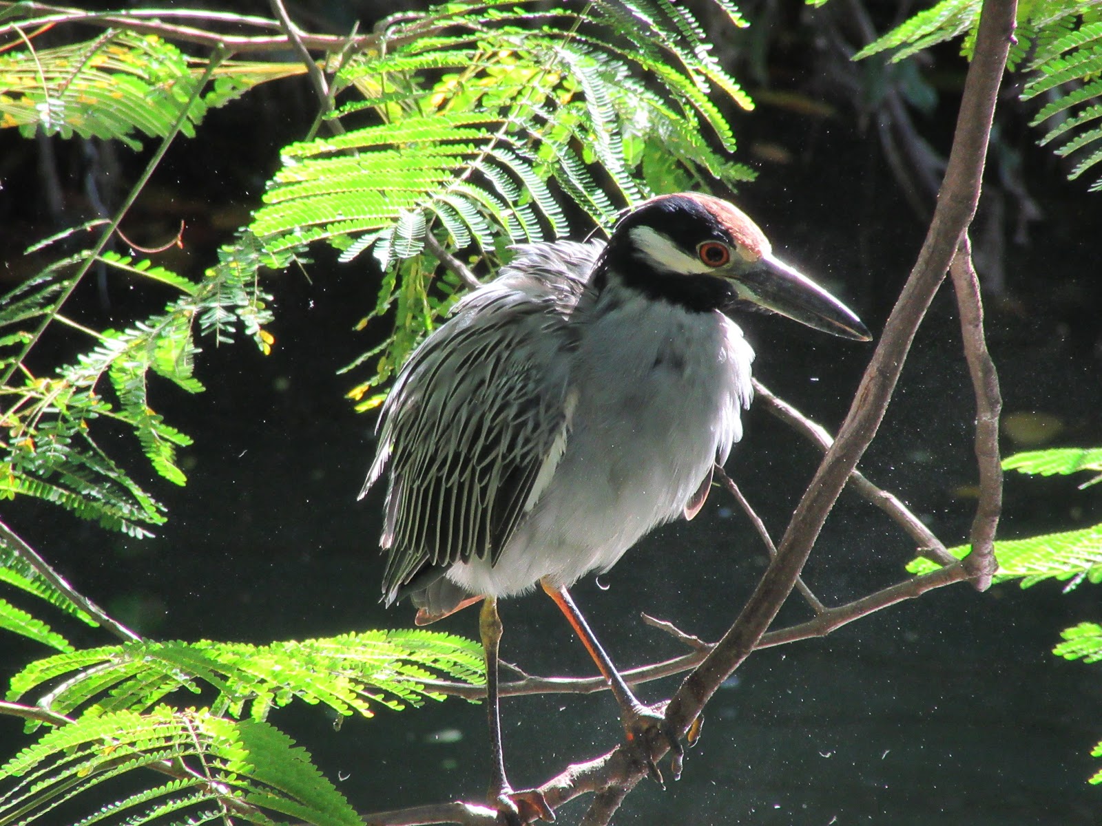
Yellow-crowned night-heron at the Rio Cuale inside Puerto Vallarta.
Great and Snowy egrets with a wood stork at the Gulf Course near the Airport of Puerto Vallarta.


Tri-colored Heron, Yelapa.

Black vultures, Yelapa.

Heerman's Gull, Mismaloya.

Black tern, Mismaloya.
Yellow-winged cacique, Playa Las Gemelas.


Limpkin, San Blas.

Northern Potoo, San Blas.

Grey Hawk, San Blas.


Masked Tityra at El Tuito.

San Blas Jay, Playa Las Gemelas.

"Garza canella" the boat-billed heron at San Blas.

Neotropic cormorant at the Rio Cuale inside Puerto Vallarta.

Cinammon hummingbird, Playa Las Gemelas.


Rufous-bellied chachalaca in the upper suburbs of Puerto Vallarta. Its common! 

I must say that all these photos were snap-shots from two very cheap cameras; birds were very tame in Mexico. For information on the bird photos in this post check e-bird account at: https://ebird.org/stamatis zogaris


Friday, December 25, 2015

Kampos Karystou Euboea Greece

I have been visiting and taking nature notes at Vidra Pond since summer 1984. This is a personal pilgrimage so please excuse the selfie.


Kampos Karystou Evia (Euboea) Greece
December 23rd 2015 

One of my home turf sites is the Plain of Karystos, also known as Kampos Karystou. This is located in the southern part of Euboea Island near the tiny port town of Karystos, where there is a very large Natura 2000 area (part of the EU Natura 2000 ecological network of protected areas). However the Karystos plain is no longer in the Natura 2000 site because it was excluded from the larger area in 1999 after a band of locals black-mailed the Greek government into effectively shrinking the Natura 2000 site in order not to include the then touristically very valuable coastal area. However, paradoxically the nearby Natura 2000 site is still called OROS OCHI - KAMPOS KARYSTOU - POTAMI - AKROTIRIO KAFIREFS - PARAKTIA THALASSIA ZONI (GR2420001). Anyway...

During the late '90s some locals did something unspeakable in their fear and rage against the inlcusion of their private property within the proposed Natura 2000 protected area. They cut over 200 willows lining the mid Rigia stream and dumped a few hundred truck-loads of construction site debris in the coastal wetlands of Rigia and infilled the artificial ponds of Souvala. The foundations of two large buildings were also built in the middle of Rigia Marsh in an effort to prove that the (wet)land is PRIVATE. These acts of sabotage have disfigured the Karysos Plain's best habitat areas quite a bit, but much wetland still exists and it is still a beautiful plain to enjoy a natural history tour. The unique thing about the plain is that it is enriched by high ground water levels and even during a period of prolonged drought there is still much water. This winter local farmers are complaining about the lack of rain-fall and the weather is automn-like. I visited on a day-trip from Athens (Ferry from the port of Rafina to Marmari) and tallied 37 species of birds during the 4 hour survey. I describe the tour here. 


I started in Karystos driving and stopping at each numbered site. In red is the driven route and in yellow the mini-walks I made at each stop. The tour took place from 11:15 to 15:30 and then I ended up in Marmari to take the ferry back to Athens.

Lala stream river mouth (site 2) just west of Karystos. The landscape is Cycladian almost.

Lala stream (at Pigadi Pasa) just before the river mouth (site 1). Near here was the very famous "Disco Vatrachos" in the mid '80s for those who remember... (Appropriete since Vatrachos means Frog).
Veiw seaward from Rigia Bridge (site 2). The lowermost part of Rigia has permenant water for about 1000 meters - even during the longest droughts. 

Rigia river mouth - a closed "estuary lagoon" (Site 3). This really interesting habitat type is really a closed stream mouth but it does form a near permenant pond on intermittent streams throughout the Aegean. The beach acts as a barrier and breaks only during winter and spring rains. 

Rigia river mouth - reed bed. Site 3.
Rigia river mouth - a closed estuary lagoon. Site 3.
Rigia river mouth and the Rigia marsh (Αλμύρες του Σαραβάνου). Mount Ochi in the Distance. Site 3.
What I consider Otter prints in Rigia marsh. Now you really need to have seen a lot to interpret this from these bad photos in very soft mud. Dog and fox prints where also present. Site 3
Otter prints in Rigia marsh. Site 3. Otters are really scarce on the islands of the Aegean. This plain has a tiny isolated population.
Otter prints in Rigia marsh. Site 3. I add more shots since i am not 100% sure. I found no spraints anywhere.
Glass-worts (probably Salicornia) at Rigia marsh. Sheep trails. Site 3. 

Mid part of Lala Stream. Site 4. 
Vidra Pond. Site 5. 
Vidra Pond. Mount Ochi towers above. Site 5.  This location is on the south side of the pond - the only site where it is possible to peer inside the wetland since it is overgrown all arround. This opening is at:  38° 1'6.38"N,  24°23'46.41"E.
Vidra Pond is an artificial clay pit dug in the early 1970s, it is about half a hectare in size and has Eel, Gambusia, Knipowitschia caucasica goby, and grey-mullets. I saw two or three huge grey-mullets jumping today. Site 5. 


Arundo cf. plyni reed cane in an abandoned field next to Vidra Pond (Site 5.). This is the field you need to cross to access the pond from its south side. The pond is in the distance where the reddish willows are. Stop on the dirt road at postion  38° 1'1.33"N,  24°23'43.18"E and open the tiny wire fence and walk in diagnally veering right for 180 meters, towards the willows. A GPS will help!


Mid Rigia. This is another pool in the stream bed and it is intermittent at this area. This part of Rigia was practically logged to degrade the willow wood that existed in the '90s. Site 6. 
Striped-necked terrapins were really abundant! Amazing for a winter day. Site 6. Since these photos are taken with my Sony Z1 cell phone I cannot not get close-ups. They are wary and I have found parts of them in otter spraints in the past.
Souvala Pond (what's left of it after extensive in-filling). Chaste trees all around. Smoldering burnt rush meadows in foreground. Shepherds burn the Juncus acutus in the winter. Site 7.
Dead pond terrapin killed by burning of the rush meadows. Site 7.
Intermittent upper part of the Rigia stream. Its almost like a wadi. Tree frogs were croaking here and during the long scorching summer it is usually totally dry. The chaste tree bushes are great reptile habitat refuges.The area is heavily grazed here. Site 8.

Unusual eutrophication in one of the pools in the intermittent part of the upper Rigia stream.  Perhaps untreated waste is dumped here - this is a common event in many agro-pastoral plains.  Several frogs were active .Site 9.

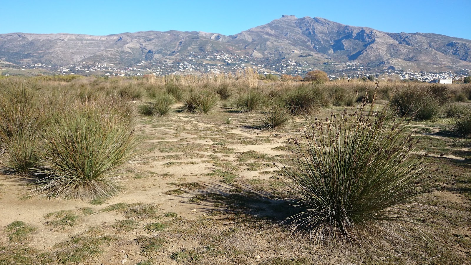
Rush beds (dominated by Juncus acutus) and open wet meadow habitat north of the bridge of Rigia. Its a very very dry winter, you can tell here. Usually frequent winter rains flood these habitats. They are heavily grazed. Site 2. 


2018 - UPDATE

For anyone interested in the conservation prospects of this site WWF-GREECE has published an article on this at: wwf.gr:oi-ygrotopoi-toy-kampoy-karystoy.

The article by Nikos Georgiadis refers to the extent of the wetland thata has been in-filled by construction-site debris and other trash in the last year (bright green delineations below). The wetland areas are delineated in red and given codes on this helpful map also.

Map courtesy of WWF-GREECE showing the three wetland units of the Kampos Karystou (Karystos Plain Wetland).