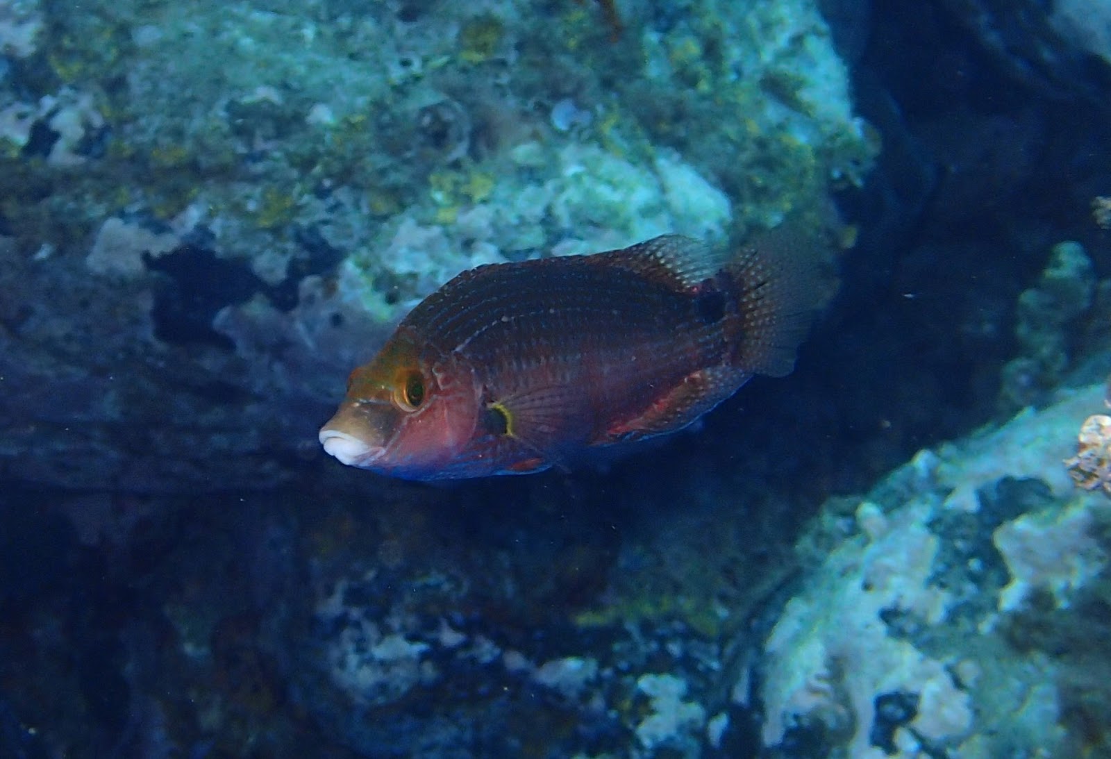
Sunday, September 8, 2013

Samothraki: Marine Fishes


Mid-August 2013

RAPID FISHWATCHING SURVEY

In between "upland wetland-stream work" on Samothraki I managed to get 7 rapid snorkeling dives.
These I call "Rapid Fishwatching Surveys- RFS"; an easy look-see technique to record the fish community (i.e. species richness, relative abundance (guesstimated per spp. per dive), and record of larger or interesting individuals (specimens larger than 15 cm noted). Of course this can be combined with photography. Three of us did quick snorkels but only I recorded fish on a wrist-pad underwater. The other two colleagues mainly spearfished (N. Skoulikidis =NS and D.Zogaris= DSZ, my teenage son) . The results of my RFS are not that spectacular but they are worth mentioning, especially since so little knowledge of inshore shallow coastal fishes exists for Samothraki. 


RESULTS
Fig. 1. Google Map of sites snorkeled. 

Seven sites were visited (mapped above). Here some locality and habitat details are given; the sampling effort (i.e. CPUE) estimation is probably best assumed relative to the time spent in water but local conditions and personal interested affected this. Observations - and length of stay in water- are all relating to my time and personal documentations. Observations by NS and DSZ are given in parentheses. [In brackets the date of survey at each site is given]. I may publish a species list elsewhere, species identifications of all photographed fishes are not yet verified.

These are the sites and scenes I saw:

1. Agia Paraskevi (NE side). Small reef-islets just offshore tiny church beyond typical cobble beach.  

c. 60 mins. very clear (visibility 15 + m.); beautiful seascapes, mixed bottom; checked quite well, Perfect quite snorkeling mid-day conditions.[14.08.2013] 

-20 Fish taxa observed. 
-Largish mugilids (i.e. grey-mullets) and large numbers of Salpa (Salema Breams). 

(NS spotted a Dusky Grouper nearby; but I saw not a single specimen)

2. Yiali (SE side). Shallow swim near steep-dropping cobble-boulder beach. Quite clear. Very deep water offshore.

 c. 40 mins. Swim at sunset. Clear waters rather monotonous boulder-dominated environment. [13.08.2013]

- 18 Fish taxa observed.
- Lots of spearfishing takes place here (4 individuals were spearfishing at this far-off place). 

(DSZ saw a huge Moray Eel; None of us saw any groupers or any large pelagics. Ok, I expected sharks here!!).

3. Agios Petros (E side) near Kipi. VERY strong west-east current very turbid situation; visibility 8 to 10 m at best.

c. 60 mins. Snorkeling near spear-fisher this time (DSZ), poor visibility and high waves impeded careful observation. [14.08.2013]

-15 Fish taxa observed.
- Lots of bigger-sized fishes here; dusk dive proved quite rich.

4. Agistro (NE side). Near Agistro River Mouth there is a Cape with varied bottom (close to small building labelled "Samothraki Diving Center" - which was closed). Extremely strong west-east current making observations and swimming difficult. Varied rocky but shallow. [15.08.2013]

c. 20 mins. Not adequately sampled - incomplete survey. Turbid: less than 8 m. visibility - strong current impeded observations. 

- 11 Fish taxa observed.
- More than four spearfishers working the area.

(D.S. Zogaris saw a school of fantastic large billfish type fish that remain unidentified - seven largish specimens he says.Other fishermen gave us a huge Mugil cephalus they had hit; they had also speared a huge octopus - maybe 3 kg).

5.Aegaion Hotel Beach (N side; just west of Therma Harbour). Typical cobble boulder bottom with some posidonia beds and sandy flats offshore. 

c.30 mins. Late sunset snorkel, very rapid and recreational view not all habitats checked. [18.08.2013]. 

- 11 Fish taxa observed.
- Lots of Salema Breams.

6.Pacheia Ammos (SW side of Island). Varied seascapes. First went to the west (large house-sized boulders) then the sandy area and to the east (cliffs).

c. 90 mins. Late afternoon snorkel. Wide range of habitats checked; spectacular area. [19.08.2013]

- 29 Fish Taxa observed.
- Only place several species seen on island including Thalasoma pavo
- Fantastic but really small Stingray Dasyatis pastinaca

7. Pygos Gateluzi East (N Side). About 2 km east of Palaiopolis archeological site.

c. 15 mins. Midday break, not surveyed just checked; but placid conditions. [20.08.2013]

-17 Fish Taxa observed
- Typical same stuff seen along most beaches of north coast. 

DISCUSSION

-It is interesting for me that several spp. of fish common in the south are missing (e.g. parrotfish, cardinalfish, groupers). Other species are present but extremely scarce and seemingly localized (Serranus cabrilla, Thalassoma pavo). Of course I compare this to experiance in the Centeral Western Aegean.

-Generally waters were clear and at two of the seven locations as clear as the clearest in the Central or Southern Aegean.

-Waters were generally warm (not like Samos or Lesvos - the Eastern central Aegean up-welling area).

-There is no doubt in my mind that these areas are over-fished and especially by spearfishers. Species such as Grouper and the large labrid wrasse (Labrus spp.) are very very rare now. I saw only three specimens of Labrus sp (one my son shot!). I saw no Groupers at all.

-Despite the above comments in many places Sparids, Mugillids and Salema Bream were in much larger numbers and generally larger than those seen in Central West Aegean waters (i.e. Eubean Gulf/ Southern Euboea). 

- The local igneous rock geology makes the underwater scenes different from a limestone/marble or metamorphic rock dominated seascape. Rocks are rounder here. The characteristic round boulder-cobble beaches of the north coast are iconic of Samothraki, but very boring. Few bays, out-lying reefs, islets exist to make the forays exciting on the north and north-east coast. 

- This first survey trial is a very crude subjective quick-glimpse and cannot given much scientific understanding. More work, either casual snorkeling of this type (RFS) or more structured observation is necessary and could be very interesting for education and monitoring.

PHOTOS


Northern Aegean Light! 15 m + visibility at Agia Paraskevi.
I got good videos of these tiny Salema Breams. Agia Paraskevi 
Big Grey-mullets by-pass Dimitris - my spear-fishing teenager - at Agia Paraskevi.
Painted Comber Serranus scripta. Agia Paraskevi 
The Wrasse Symphodus mediterraneus. Agia Paraskevi 
View from chapel of Agia Paraskevi.
Coast towards Yiali from Kipi Beach - wilderness!
Ok, this is where I would expect a GWS to come into view (Yiali).
Yiali. I think this is over-fished; these breams should be bigger - too many spearfishers...
Agios Petros, close to Kipi - very strong current, rich habitat. DSZ is searching for groupers...nothing!
A "huge"wrasse, Lambrus merula. This genus has probably suffered gravely from spearfishing. DSZ shot this one - I cannot forgive him!
Aegaion Hotel Beach. After sunset.
Aegaion Hotel Beach. After sunset (small Salema Breams).
Pacheia Ammos: The most beautiful beachscape and seascape on the island: threatened by beach-side developments...
 Striped Red Mullet, Mallus surmellatus - most people don't now they come in different colours (Pacheia Ammos).
Red Mullet Mallus barbatus - note no stripes on dorsal; called "Koutsomoura" (snub-nose in Greek) at Pacheia Ammos.
 Brown Comber Serranus hepatus; only one spotted (Pacheia Ammos).
Small gravel goby called, Bucchich's Goby Gobius bucchichi  (Pacheia Ammos). 
The Common Seabream Pagrus pagrus (Listed as ''Endangered" in IUCN assessment). Only one spotted at Pacheia Ammos.
The only elasmobranch seen: The Stingray Dasyatis pastinaca at Pacheia Ammos (3 m. depth).
Common Octopus at Pacheia Ammos (defensive posture on sand, perhaps mimicking a ray or something dangerous...).
The commonest flatfish in Greece in the shallows is the Wide-Eyed Flounder, Bothus podas (Pacheia Ammos).
Nearly 20 m. visibility at Pacheia Ammos.
Cliff habitats to the East of Pacheia Ammos.


Thursday, August 29, 2013

Samothraki Inland Water Fishes


Mid August 2013

On Samothraki we researched waters. Invertebrates, water quality, riparian vegetation, wetlands, birds, marine life, conservation issues of all sorts, and fish.

One of our team's passions is studying fish in inland waters - any waters inland of the shoreline. Fishes are interesting because they require really special conditions and resources for survival in any inland waters; and conditions on small islands are usually difficult. On Mediterranean islands, stable inland water conditions are scarce. This includes coastal lagoons, stream mouths, and any isolated water behind the beach-fronts (all wetland types of course) and streams of course. On islands, stream freshwater fishes have a hard time surviving - they cannot live without freshwater, so even a single dessication event can render them extinct from an island. On the other hand, marine fishes that swim into inland waters and move upstream need barrier-free movement opportunities and these conditions are rare or often influenced by human water exploitation and various barriers (road-crossings, dams, weirs).

What we found in Samothraki

Working on seven of the most representative of the basins we electrofished and used seine fry nets to collect fishes. Of these only Agistro, Fonias, and the Agios Andreas Lagoon had fishes! (see map below). Although we sampled using the above equipment 10 sites (8 using electrofishing) only six sites had fish. I present initial findings here- some spp. are still not confirmed as to their exact identification.

We found the following taxa of fishes in Samothraki's inland waters:

-Three species of Mugillids (Grey-mullets): these marine fish breed in the sea but enter fresh and brackish waters to feed - they love to feed on algae and detritus so they probably contribute to the cleansing of eutrophic lower stream reaches.

-Two or three species of Blennies: in this case we caught wholly marine Blennies - species that enter fresh and brackish waters but probably reproduce in the sea only.

-Two species of Gobies: One unidentified species and one common marine sand goby have been collected.

-One species of Atherina (sand-smelt): Collected only at Fonias river mouth in large numbers; they commonly enter rivermouths and lagoons when there is an opening to the sea.

-One species of Eel (Anguilla anguilla): Collected only in two rivers, in fact the two which have a good connection to the sea and are mostly perennially flowing towards the sea (Fonias and Angistro). The eel is a globally endanged species, so this find lends special value to the inland waters of the island.

So the inland waters ichthyofauna of Samothraki have a total of at least 9 fish species. This is good, but still we have  mysteries and unanswered questions. I was searching for a 'Dwarf Goby' called Knipowitschia caucasica, collected by Bulgarian researchers and published in the '60s; it was found nowhere.

Also, we found no true primary freshwater fishes. And this is remarkable since so much freshwater produced on the island flows to the sea - and at Fonias river for example we could have had a population of say River Blennies and even true primary freshwater fish. Our team searched hard - at one instant I had a hallucination that I saw a River Blenny at Fonias- it was probably a tadpole.


Samothraki Island and the river basin areas where we actively searched for fish using specialized fishing equipment; we visually inspected many other waters and small wetlands also.
The Fonias where we caught a 70 cm Eel - at mid-stream about 3 kms from the sea.
Walking along the Upper Fonias (Karya) at about 750 m. asl. Very slippery! 
The local super-widespread Ranid frog. This species is especially abundant where no eels exist!  Tsivdogiannis river.
The Upper Gria Vathra river at 700 m. elevation. Deep granite pools, slippery!!
Electrofishing the lower Yiali River in SE Samothraki. No fish here.
Its not just fish we find in river corridors: Dr. Yannis Karaouzas holds a beautiful Dahl's Whip Snake (Platyceps najadum) we caught in the upper part of the Fonias. Generally snakes were scarce; I saw only two Grass Snakes and this species after 13 field days on the island.
Fonias River mouth - only it and Agistros where flowing with an open mouth to the sea.
Atherina boyeri schoals caught inside the river-mouth of Fonias. Should have kept them for dinner...

I suspect these tiny Grey-Mullet fry are Mugi cephalus - caught at Fonias River Mouth.
Another Grey-Mullet, should be Liza Ramada. Many in the Fonias for about a 1000 m. upstream from the river mouth. But a large individual like this is only downstream due to anthropogenic barriers to movement.
Another Grey-Mullet; this time the Boxlip Mullet Oedalechilus labeo identified by the golden stripes and the charactersitics of the mouth-parts (broad and tall lip) Agistro.
Boxlip Mullet Oedalechilus labeo closer look at head. 
Boxlip Mullet Oedalechilus labeo in the Fonias stream, c. 150 m from the rivermouth in freshwater; this is the first time we catch this marine fish in freshwater! 
Team leader, Dr. N.Skoulikids inspects Katsambas river mouth - low water this year.
An anonymous wetland between Fonias and Ag.Paraskevi chapel. Brackish conditions, no fishes apparent but Mauremys rivulata (Terrapins) found! (One of only three sites we saw them on the island).
 Dr Zbigniew Kaczkowski expertly handling an Eel at Agistro river mouth pool.

Really BIG Eel at Agistro pool. Here we found four eels in a stretch of 80 m along the stream!

We saw three eels of this size on the island (here at Agistros - mid-stream section). Rare sight indeed!

Underwater snap-shot of the really BIG Eel at Agistros Stream.
Underwater snap-shot of a really small Eel (18 cm) hiding in sand in the lower Fonias river.
Agios Andreas Lagoon near Kamariotissa - great place for birding and fishing...
 Dr Zbigniew Kaczkowski with fry-net at Agios Andreas Lagoon near Kamariotissa.
'Mystery' Goby caught at both Agios Andreas Lagoon (here) and at Agistros river mouth. All were small - but abundant in Agios Andreas Lagoon. 
'Mystery' Goby (unidentified yet). It has a "salt-and-pepper" markings pattern and biggish head similar to a Gobio cobitis but we need to re-look at it carefully. The other fish is a Rusty Blenny (Parablennius sanguinolentus), both  at Agistros River Mouth. This particular Blenny species feeds on algae and is quite frequently seen at small-stream river mouths. 
Sand Goby, Pomatoschistus cf. marmoratus was common in Ag. Andreas lagoon.
Green Goby, Zosterissesor ophiocephalus was common in Ag. Andreas lagoon.
Peacock Blenny, Salaria pavo was common in Ag. Andreas lagoon.
Road-barrier to fish movements at Agistro. However some young eels do pass upstream. 

River crab (Potamon sp.) at Fonias river (Underwater shot after he bit me on the finger really hard). 
Terrapin (Mauremys rivulata) - like fish, this species also requires water! Rare on Samothraki (this one at the Anonymous wetland, mentioned above).

Ms. Anastasia Lambou taking notes at the nearly totally-dried-out Vdelolimni Lagoon. 

Researchers Mrs. Vlami and Ms. Lambou at the Vdelolimni Lagoon.

Dr. Skoulikidis carrying the electrofisher and nets through the dry alluvial fan below Yiali canyon.
The expedition team; local friend Mr. Yorgos Delos (at L.) took us by boat to the isolated river-mouth beach of Yiali.  


(Note: for further information please read: http://zogaris.blogspot.gr/2013/08/samothraki-island-natural-history.html)


Wednesday, August 28, 2013

Samothraki Island Natural History


Mid August 2013

Samothraki = unique island nature!
It's like several separate biomes in a single small island. A 178 square-km naturalist's hotspot.

I first visited the island in '83. Not too much feels changed. A rocky mountain rising high above the Thracian Sea. Not all rock: Dry rolling lowlands like Lesvos; lush village orchards like Euboea; big plane-woods like western Anatolia; and the high craggy peaks seem almost Carpathian....The sea here is different, deep dark, not the Southern Aegean.

Its not the most beautiful island in the Aegean; few pretty post-card beaches. This may have kept mass tourism from invading. But I was impressed in a touristic sense too. I found the island to be a great retreat: aspects of the tourism culture here reminded me of Greece in the early '80s... Visitors and residents were friendly, unpretentious, open. Greek visitors and many locals had a laid-back feeling. Many people hitch-hike on Samothraki. Many hippies retreat here.

The deeper reasons I was so impressed involve natural history assets and local conservation issues: 

1. Unique relief and geology. The island looks like a chunk of the High Tatras in the Aegean! The igneous rock that dominates Samothraki is rare in the Aegean (most islands are calcareous, or simply limestone dominated). Over 20 river valleys break-up a steep rugged mountain range peaking at 1611 m. asl. It is one of the highest peaks in the Aegean (only Euboea and Crete are higher!). The high relief situation also creates a special bioclimatic situation- lots and lots of snow in the winter.  

2. Unbelievable mountain waters. Many dozens of kilometers of mountain streams flow perennially, and small rivers continue to flow and create spectacular "river pools" in mountain valleys even above 800 m. elevation. Huge granite river pools, locally called "Vathres" are unique in the Aegean....no other island has this much mountain lotic water in Greece. We estimated at least 10 river basins have long perrenial stream reaches - another unique attribute for an such a small Mediterranean island.

3. Old and extensive natural woods. Although large areas of the mountain were denuded by fire and have  undergone rapid vegetational degeneration due to goat over-grazing pressure, there are still old native woods. Ancient oriental plane woods and extensive stands of Quercus petraea oakwoods are fantastic. Extensive Alder (very rare in the Aegean islands); and dense tall Strawberry Tree, Tree Heather woods and mixed high-maquis of various types clothe lower parts of the mountain. Even canyon woods and juniper woods exist. But most of the mountain is totally bare - with a real alpine feel. 

4. Wonderful small wetlands. At least 16 wetland sites are identified (12 in a recent WWF inventory); I visted 12 sites - four new to the inventory (and this was a dry year; so the list is incomplete...).  The most remarkable and largest is Agios Andreas Lagoon. This wetland complex with its two adjacent lagoonal wetlands, the headland sand-spit and rolling landscape near Kamariotissa is an excellent birding area - one of the most interesting I have seen in the Aegean islands. Next "most important" is the Vdelolimni lagoon- the only one I know in the Greek Islands which is fringed with Alder. Most of these were dry this summer - only four wetland sites had fishes this summer. So although some naturally dry-out, others are certainly vulnerable to artificially desiccation due to water over-exploitation.

5. Wilderness coasts and mountains. About 60% of the island is a mountain wilderness -  NO ROADS! How many places in Greece's mountains have no roads? (Very few...). The south coast from Kipi Beach to Pacheia Ammos is an amazing 11 km long coastline of high gradient wooded slopes and moonscape rock-faces, scree slopes - it seems like 100 kms long.... It reminded me of Agion Oros (the Holy Mountain). No mountain villages exist - above the settlements is a landscape akin perhaps to the Madares (or High Desert) of Crete. Very rocky - raven's country....

6. The cross-roads island biogeography. An island in the "Northern Aegean Marine Ecoregion" right next to the Dardanelles Black Sea Water Inflow and across from the shores of Thrace and Anatolia. A stepping stone between Europe and Asia. Winters are Balkan-cold here; summers are Mediterranean, and the mountain feeling is Eastern European- perhaps almost Pontic - eastrn! This is how Samothraki's biogeography felt to me.

7. The rarity of things. 15 endemic species of plants as a recent review shows (Biel and Tan 2013 in progress); although "Samothraki remains one of the botanically least explored of the major Greek islands". The flora is rich and is an "interesting mixture of continental and Aegean elements" says Strid and Tan (2009) and many continental species exist while many Aegean species find their northern outpost here. Its not just rare (or range restricted plants); some very interesting habitat types exist also (Juniper woods, heaths, alpine rock areas, pseudo-phrygana, various wetland types etc, etc..). And wildlife too: In terms of birds, or other animals the island is poorly studied - much of it is so inaccessible. But rarities exist, despite the generally depauperate insular wildlife communities as compared to the adjacent Thracian mainland. I recorded only about 44 bird species on this trip but was not really looking hard. Some small raptors were present and some rather rare waterbirds in the wetlands (it is and official terrestrial IBA also) - so more surveys are needed.

8. The "riches" of the sea. A different sea: The "Northern Aegean Marine Ecoregion". Many reasons make this so different: The "Black-Sea-Water" and respective currents; proximity to the Evros estuary and Samothraki's many rivers; uncommon geology, the great Anatolian Trench (900 m. deep) etc. It is much more eutrophic perhaps than the south and central Aegean. Snorkeling in these waters brings up differences- the benthos seems "bushier", yet two of the 7 sites I snorkeled had great visibility (over 18 m.). Marine life is seemingly quite rich. The sourrounding waters are Marine Important Bird Area (IBA). Wildlife thrives here - we counted up to 25 Audouin's Gulls at one spot near Kipi; Med Shags are common everywhere, and we saw Striped Dolphins twice. But overfishing has probably precipitated catastrophic changes here as well (spearfishers everywhere...).

9. Low-key development. Many islands in the Aegean have lost their character; they are quite tacky - touristy, grotesque caricatures of their recent near-medieval being (see some of the touristy central Cyclades, for example). Samothraki is still a "working island". A big fishing harbour and a strong livestock breeding island. Tourism is also important here, but still very low-key- most people come from Alexandroupoli. Very few holiday homes, or out-of-conurbation tourist developments have been completed. There is still hope to curb mass tourism here. Perhaps quality tourism development can be an incentive (so there is still hope...).

10. Ecotourism potential. Samothraki is in the Evros Prefecture. The Evros - one of the most important ecotourism hotspots in SE Europe!!! Samothraki as an ecotourism destination ties in well with the Evros Delta and Dadia National Parks nearby (and Turkey also has a naitonal Park on its share of the Evros/Meric Delta). Samothraki's location next to the Turkish-Greek frontier is important in showcasing the island as a site of international conservation area status. The historic cities nearby are now modern Euro-Asian crossroads: Constantinople, Adrianople, Dedeagats, Salonica, Imvros, Sophia, Phillipoupolis: All very close to Samothraki - the only Greek Island to easily connect continental cities with the wild north Aegean. Can Samothraki become an international meeting-place that brings together the Evros Valley/Thracian conservation initiatives to the world? There is potential here I believe...

I spent time thinking about Samothraki. After a lot of discussions with my colleagues, with the Mayor, and many friends; much brain-storming and a lot of nature study throughout the island, I feel that Samothraki needs a proper protected area development. The Mayor proposed "National Park" status. Also an excellent proposal for a UNESCO MAB reserve designation has been drafted. Of course, a "real protected area" now, in mid-crisis Greece, in this far-flung place, is not easily possible. (This, despite the fact that already most of the island and the surrounding seas are designated Natura 2000 areas - so Greece has an obligation to provide conservation here). A real reason for a high-status protected area designation is the really pressing local environmental problems here. The anthropogenic pressures on Samothraki's landscapes are at a crucial threshold - so now is the time to think strategically and act locally!

Urgent study and practical measures are needed to deal with the following pressing environmental issues. I isolate these four since they where most noticeable as "issues" degrading the island's nature during our 2013 expedition.

a) Land-use planning, tourism management, building sprawl; poor urban planning/architecture issues. These issues are changing the landscape- impinging on aesthetics and creating artificial fragmentation: roading, fencing, in-filling of wetlands and mini land-conflicts. Agriculture land may be reverted to buildings if tourism begins to boom (hopefully it will not boom!). The problems are mostly on the north coast but locally elsewhere. Aesthetically sensitive landscapes such as the beautiful Pacheia Ammos are obviously threatened. Fortunately these problems are localized but significant. 

b) Water mismanagement and water/ river corridor conservation, including wetland protection, riparian buffer protection and enhancement-restoration. Although the island is water-blessed; water mismanagment is serious and widespread. The issues range from creating 'artificially intermittent' reaches in formerly perrenial streams (due to ignorant irrigation abstractions), to drying-out of wetlands, wasting waters and other insiduous mismanagement. A comprehensive management for water does not exist and EU-funded plans to further exploit river surface waters for irrigation (i.e. at the Ksiropotamos) need to be carefully reviewed and assessed. Most people don't realize that the watery life-blood of the island is so threatened. (However during this summer only one river flowed perrenially to the sea- the Fonias; under natural conditions I would expect at least 5 to reach the sea during summer. And as a consequence - we located eels in only two rivers..). The many lower portions of the rivers are degraded, and we found polluted sections too (urban sources).

c) Grazing management and forest protection. Severe vegetational degeneration has recently taken place and old growth woodlands are threatened; this is one of the most difficult and widespread threats on the island. I don't think the erosion problem is so severe, loose-soil tectonically active places like this naturally create local badlands (see the Ksiropotamos Valley); but grazing does increase erosioal phenomena. The grazing pressure has increased due to EU subsidies- so the vegetation degeneration process is a critical problem. Nowhere did we see deciduous oak tree regeneration. Places like the Martini Forest which are being logged for firewood are have NO REGENERATION whatsoever -so I don't understand how and why they are being selectively logged. Fire strategy does not exist; this is a problem. But on a positive note, the grazing does keep forest litter low - and this may help abate canopy fire or megafires. I predict a catastrophic fire will take place if care is not taken - so a scientific comprehensive multidisciplinary approach to solving the overgrazing problem is needed.  (Also, in my experiance in Arta and Karystos band-aid applications through fencing small plots or even larger plots are not the sole solutions).

d) Overfishing and fishery management. Planning, enforcement, policing and awareness are critical. Spear-fishing for example is rampant and totally uncontrolled on Samothraki. Even dynamite is used for blast-fishing still (we where told by several locals). In my snorkling serveys I did not spot a single Dusky Grouper - could this be indicitive of a catastrophic decline? Generally this issue of over fishing is problematic across the Greek Aegean - how can we make it better here? (A pilot applicaiton maybe...this has some potential since the island is small and can be easily policed if there is a will for this...).

In this sense, a "mega-incentive" for landscape protection, rational resource management, sustainable agro-pastoral development and ecotourism promotion could be the island's upgraded "protected-area" status. I vote for "Samothraki National Park" but scientific study is gravely needed here first. Secondly, monitoring -carefull long-term observation must be applied to follow-up and guide eco-development.

Hope we will stay close to Samothraki....

(I would like to thank HCMR river monitoring sampling team, our Ichthyologist volunteer from Poland, and many local friends for all thought, work and support that went into the 2013 Samothraki Expedition; I will not post pics on this blog post - too busy this period - sorry...the air-photo is from the intenet - Big thanks to whoever took it!)

Monday, August 5, 2013

Schinias-Marathon National Park: Ichthyo-tragedy (Part Two of Two)


Early August 2013

On the 18th of July, Radek Sanda and I visited the sluices at the Olympic Rowing Center Lake within Schinias (a national park 30 km east of Athens). I described the situation in "part one" of this report. Here I give some photos of the fishes and the sluice-problem that entraps them. These are probably the first published photos of the Marathon Minnow from...Marathon. It was thought to be extirpated from this site, as stated in IUCN Red List (see http://www.iucnredlist.org/details/135721/0)*. This is of course due to very low interest and understanding of small-fish distributions - normal. 

Anyway, here I show some of the conditions in Sluice 1 and Sluice 2. HCMR researchers and HOS members will again visit the sluices to "monitor" the situation this summer. Hope there is no mass death! 

* IUCN Red List states: "The species is now only known from springs and rivers in the Sperchios and Kifissos drainages, it is extirpated from the Marathon plain which was drained for agriculture. The extent of occurrence of the remaining distribution is less than 10,000 km², where there is a continuing decline in water quality in the rivers (but not the springs) from agricultural pollution, the species is also threatened by drought and water abstraction, and in some springs there is stocking of Oncorhynchus mykiss which will eat P. marathonicus"Freyhof, J. & Kottelat, M. 2008. Pelasgus marathonicus. In: IUCN 2013. IUCN Red List of Threatened Species. Version 2013.1. <www.iucnredlist.org>. Downloaded on 06 August 2013. 

Marathon Minnows (Pelasgus marathonicus) known as Attikopsaro in Greek; small individuals from the Rowing Center Lake at Marathon.
Sluice 1. Infamous for mass deaths of fishes a few years back. On the L is the artificial Rowing Center Lake, on the R is the culvert leading underground to the Great Marsh of Schinias.
Radek sampling and collecting water samples too at Sluice 1. The sluice canal is about 2 meters deep, maybe more. 
Sluice canal at Sluice 1. Many fishes, including Eels are usually visible. Amphibians and snakes often get trapped here too. 
Snap-shot of Marathon Minnows from above, in Sluice 1. Conditions are still OK. If drought continues and conductivities increase they will all die.
Sluice 1. Foaming waters, fish and amphibians also get trapped here. This situation need a therapy!


Schinias National Park: An Ichthyo-tragedy! (Part One of Two)


Early August 2013

Greece is sadly not famous for its effective protected-areas. Many other Mediterranean countries have similar problems, but we all continue to believe in protected areas. And we all want to see new ones, better ones, experimental ones. This is good, its part of an evolving cultural experiment - to design circumstances to protect and promote nature as best we can -  in protected areas.

One of Greece's most recent protected areas is Schinias Marathon National Park, a nearly peri-urban site, just 30 Km east of Athens. And Athens and Attika have few areas for biodiversity conservation, so Schinias definitely is worthy of a rigorous conservation scheme. However, the National Park status granted to the site has been criticized since the area was created under suspicious circumstances during the hasty development of the Athens 2004 Olympic Games. Schinias was chosen as the site of the Olympic Rowing facilities development and this was constructed out-of-the-blue in Marathon's Great Marsh. The Great Marsh is world-famous for its role in the historic Battle of Marathon (490 BC).  During the last few decades this now partially-drained marsh functioned as a military telecommunications antennae area, so this is how it was actually saved from the mega holiday-home construction boom. No-one really cared for the history or biodiversity.... Today holiday-homes and villas, green-houses and farms surround the marsh and wooded beach and the 2 km-long rowing-center lake dominates at its western edge. It is unusual that there is so much water here - and this is why it is an amazing life-rich wetland!!

Well to make a long story shorter, there is a truly unique karstic spring at "Makaria Pigi", and this is the "great source" that fills the new Olympic Rowing Center Lake and once fed the marsh. The long rectangular lake creates an interesting opportunity for biodiversity conservation. If scientifically planned and managed  the "excess water" that once was channeled straight to the sea could feed the surrounding partially-drained wetland area. And this was part of the compensatory scheme promoted during the Olympic Games rowing center development in 2004.  The National Park decree was drafted in the wake of the multi-million euro Olympic Games development. And, surprisingly, it partially worked! But since no ecological water management plan was ever enforced and no one really cares for the wildlife- no one really knows what is going on in the "Park" in terms of biodiversity conservation. The government failed to organize the management of the park and it failed in supporting monitoring and restoration. But with the extra water, nature bloomed. Gravity sees the water through the new lake, canals, sluices and now a lot of water does end up in the Great Marsh. And the Great Marsh has noticeably revived. But this story is not just happy and "green".

The ichthyo-tragedy

Between the Olymping Rowing Center Lake and the marsh are two simple sluices and culverts running underground (under a peri-reservoir road) to the marsh. Each sluice has a canal-like impoundment structure (water overflows from the artificial lake and rushes down into the sluice channels and then into the culverts to flow to the marsh). Fish cannot pass up to the lake and they gather under the culverts leading to the lake. The eels and other fishes that are trapped in sluice canals cannot go up into the "lake" or travel back if the culvert is clogged. So many fishes and amphibians die here each summer. A few years back (in 2010) there was an amazing fish-kill, first of Marathon Minnows (at least 5000) and then of Eels ("many thousands"). At the time our HCMR team was monitoring the Park and we tried to inform authorities with no result.

With the cooperation of the Park Managment Body, this year we visited the sluices to take a look at the situation (July 18th). We found about 500 dead Marathon Minnows and over 2000 entrapped in "Sluice 1". About 30 writhing Eels were also visible - all trying to pass upwards into the lake. A huge Grass Snake (1.2 m. long) made an appearance. "Sluice 2" was flowing stongly with great quantities of water, the water was foamy and we could not see anything inside the sluice. Conductivity was very high 4000 μS. The freshwater fish may start to die soon in both sluice canals.

Management needed NOW!

The death of thousands of "near-threatened" and "critically endangered" fish is not the only thing that is wrong here. Of course we care for the fishes, but saving the fishes is not the only goal.

The Lake's excess water needs to feed the marsh habitats for a reason: it needs to provide a "near-natural water-flow regime" that will help "ecologically restore" a suite of habitats and associated aquatic species assemblages that require specific conditions. The suite of habitats is complex - it begins with freshwater conditions and ends up in lagoon-like brackish and saline conditions - so all these must be maintained through management. Since the plain is now fragmented by the artificial lake, the sluices, canals, old-antennae facilities and in-filled road networks we need to plan for the area's "flow-regime".  This must be balanced by specific biodiveristy needs as well; such as specific habitat requirements for wetland-habitat specialist bird species that helped designate the area a Special Protection Area (Ferruginous Duck, Glossy Ibis etc). Also, since the Marathon plain is full of people and buildings, there is a real conflict with mosquitoes. Water management for wildlife will need to be tied-into a plan to reduce certain seasonal mosquito reproduction conditions also, and/or to manage mosquito control in an ecologically acceptable manner. Complicated, yes!

How to save the fish?

We proposed a simple fish-ladder for the fish at each sluice - a way to redesign the sluices. This is important since during drought years many many thousands of eels, minnows, mullet, sea-bass and terrapins could be entrapped and die. These mass deaths are very dangerous in terms of creating a local bio-hazard also (e.g. botulism etc). But again this is only a part of the tragedy - we need to deal with the whole. I hope we can help create a legendary protected-area at Marathon.


Location of Schinias-Marathon National Park on the east coast of Athens.

Detail of the Great Marsh and the Olympic Rowing Center Lake which are fed by  Makaria Spring (upper L). The blue dashed lines show the flow of water from the great Spring to the Lake and eastwards to the Great Marsh. A sandy shoreline-barrier dotted by pine forest naturally obstructs drainage and the surface water's outlet is on the far right (just beyond the end of the photo). A suite of different wetland habitats of different salinities and conditions develops from the freshwater springs and lake (west) to the brackish and saline lagoonal wetlands (east). It is obvious how artificially fragmented the former wetland is today, so managment is necessary. Without management we will have a homogenous choatic mess - and a lot of mosquito-bitten residents against the Park!